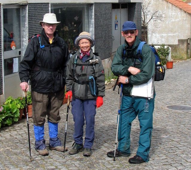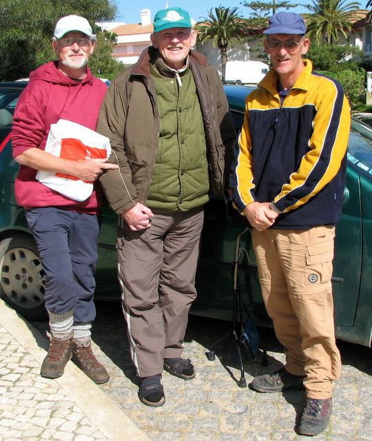
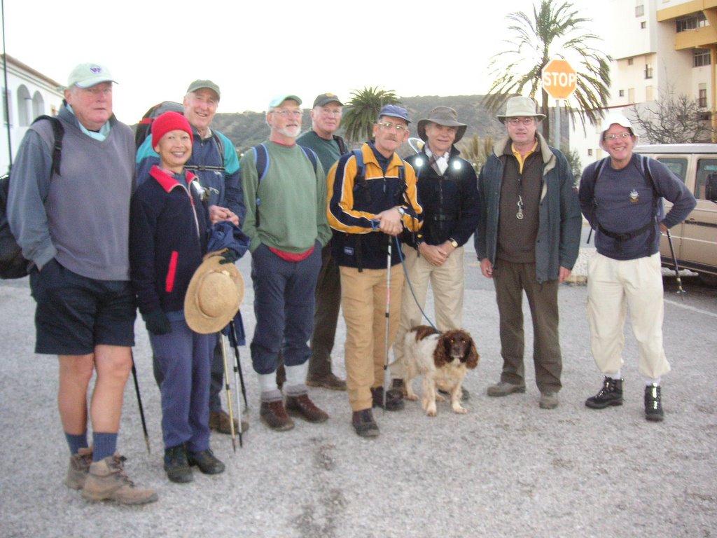
David, Maurice and Terry in Sagres 
posted by Paulo a Pe | Friday, February 24, 2006
|
0 comments
![]()
![]()
This blog aims to recount the exploits of that brave band of pedestrians, the AWW, who meet almost every Wednesday to go where no others have been before, on foot, in the wilds of the Algarve.

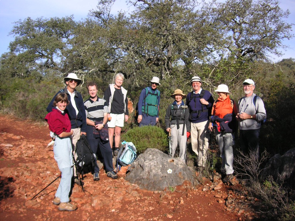
Wednesday 22nd February 2006
Walk: Praia de Castelejo to Cape St. Vincent.
Leader: Terry and David;
Present: Paul; Myriam; Rod; Ian C-S.;Ian S.; Ian W.;Hedley;Antje;Janet;
Tiggy; Muffin
Unfavourable tides on the West Coast beaches had forced Terry to do a long leg on Day 8 - from Aljezur to Castelejo Beach, so that the supporting WW's would have a relatively easy day from Castelejo to the end of Via Algarviana at Cape St. Vincent.
The climb to the Customs House from Castelejo Beach was a real heart starter, the majority led by Terry and David taking Route 1, and coming to the Customs House directly, and a Gang of Three opting for the Middle Path, and cutting across towards Torre D'Aspe without the kudos of admiring the beach views from the top.
From there it was a fairly uneventful stroll along good paths and towards the end, a very rocky heath. There was a cutting wind, which happily was behind us, and we completed the trip in a little over three hours (wind assisted).
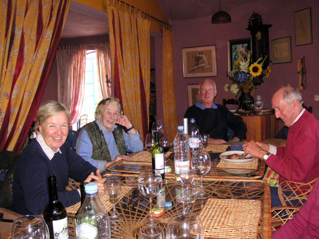
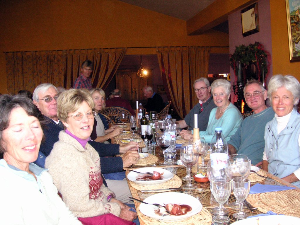
At the finish we met Jill and Dinah, and then a little later Maurice and Esme arrived.
Maurice was very pleased to show off his Graffiti skills by stencilling the last Cistus waymark on the wall of the Cape St Vincent Fort, and the whole group then got out of the wind and went to Pastelaria Baia in Sagres for some light refreshment.
Terry was remarkably fresh after his accomplishment, and with a little minor tweaking it looks as if they have achieved the aim of establishing and recording a very special route across the Algarve from East to West. Maurice did bring proceedings down to earth by remarking that now it needed to be done from West to East to make it a proper long distance path, - and I am sure it will be - Amanha!!
posted by Paulo a Pe | Friday, February 24, 2006
|
0 comments
![]()
![]()
posted by Paulo a Pe | Tuesday, February 21, 2006
|
0 comments
![]()
![]()
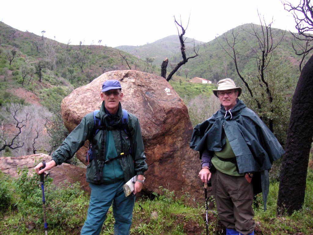
After a herculean walk on Day 6, Silves to Monchique, which involved climbing Picota in a hailstorm, Terry met similarly adverse conditions on day 7. From his lodging in Monchique, he set off at 9 am, after a splendid breakfast, up Foia where he faced driving rain and thick cloud. Despite this he made the descent in good order, by 1130 am, to Marmelete, where he met David, Myriam and myself for a welcome coffee, before continuing in our company towards Aljezur.
Navigation so far had been excellent, thanks to David's comprehensive pamplets and the regular 'Cistus' design waymarks. This didn't last. Perhaps over excited (or appalled) by the thought of having Myriam and myself for company, we missed a crucial turn and waymark just north of the Marmelete-Aljezur road, and carried on for several miles, practically following the whole of Mike's last walk, before we stopped trying to make the topography match the description. It was then I realised that there had been a warp in the space-time continuum, that had resulted in our being rather a long distance to the north of our desired track! We were getting caught in annoyingly regular bands of heavy rain, which just gave us the time to dry off and remove raingear before the next onslaught. Undaunted we selected a more southerly route, hoping to bisect the path we wanted, and struggled to the top of a large hill which gave us excellent views, as it was in the early stages of recovering from the forest fires of last year.
Aljezur was on the far horizon, and we spotted a likely path far below. Unfortunately, we would have needed hang gliders of a chair lift to get down from this particular hill, so we retreated and found a more user-friendly ridge descending in the right direction.
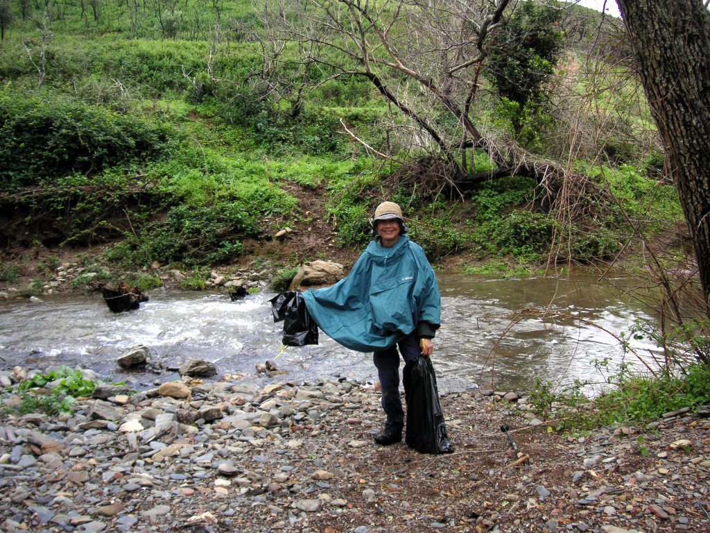
At the valley floor was the inevitable river crossing, swollen by the recent rains into a raging torrent (by Algarve standards). After searching in vain for nearby stepping stones or a handy fallen tree, we mounted a three-pronged attack on the crossing problem. I took Route One, as I was wearing my Gore-Tex gaiters over my boots, and danced across lightly at what I perceived to be the shallowest section. I made it with only one bootfull of cold water. Terry took a practical approach, removing boots and socks and experiencing a refreshing foot wash as a bonus, and Myriam brought out the hi-tech drawstring equipped Lagos Camara bin liners, and despite a puncture from a sharp rock, reported a safe and dry arrival on the far bank.
Minutes later, amid cries of 'Eureka' we located one of David's 'Cistus' Waymarks on a large rock (picture) near the path. Consulting the song-sheets we concurred that this was in fact Waymark '7', and continued on our way rejoicing.
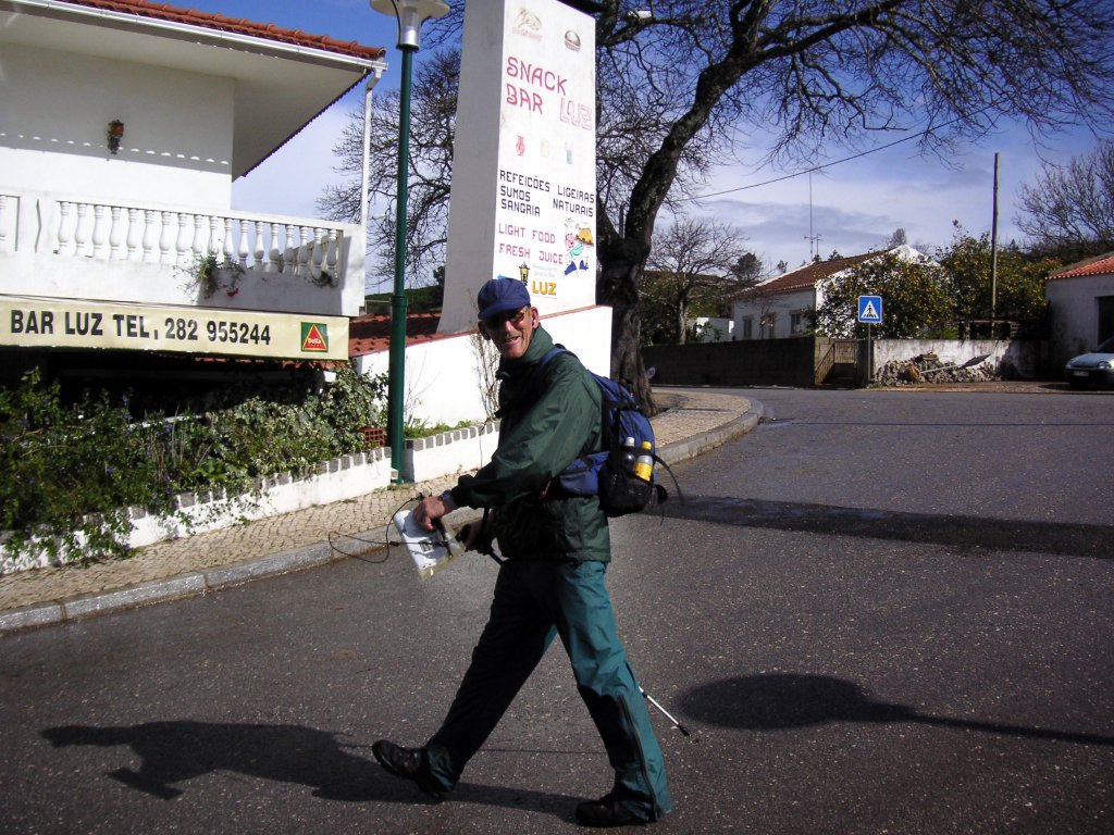
From here it was easy, although a long stretch of surfaced road seemed to go on forever, and we arrived in Aljezur about 5 pm having done about 22km since Marmelete, which had made it another long day for Terry. He settled into his lodgings in Aljezur with another tough day in prospect, with hopefully drier conditions, from Aljezur to Castelejo.
posted by Paulo a Pe | Tuesday, February 21, 2006
|
0 comments
![]()
![]()
posted by Paulo a Pe | Tuesday, February 21, 2006
|
0 comments
![]()
![]()
posted by Paulo a Pe | Tuesday, February 21, 2006
|
0 comments
![]()
![]()
Wednesday 15th February 2006
Walk: Salir to Alte 15 km 3 hours
Leader: Terry
Walkers:
David;Paul;Myriam;Gack;Hedley;Stan; Elaine.+ Peter and Nan (visitors) (10)
Nathan; Archie (2)
Comment: A lateral walk in support of Terry on the Via Algarviana
David and Terry's long project to establish and mark a definitive version of Via Algarviana reached a point in February 2006 when Terry felt that he would like to attempt the whole route solo. Back up would be provided by Jill, Dinah and David in the main, and our hero set off on Sunday 12th February, accompanied by Peter and Nan, friends over from UK for a week.
Great progress was made, and a rendezvous was arranged with the regular WW's on Day 4, Wednesday 15th, for a section from Salir to Alte. It was a pleasant cool sunny day, and I had decided to use the opportunity to attempt to log the route using Bamboo Diagrams in real time.
Apart from a blip when my Kilometer pedometer refused to record anything except random strides, and I had to switch to the good old faithful mile pedometer, I largely managed to keep up, although I haven't yet attempted to translate my scrawled shorthand into a legible booklet. We all admired the stencilled cistus flower Waymarks, which taken in conjunction with David's written description, should enable anyone to follow the route with ease.
Maurice, whose original concept had been to lay out the path across the Algarve from Alcoutim to Cape St Vincent, was very excited about Terry's attempt, and had cajoled Esme into bringing him to Alte to meet us at lunchtime. The walk was shorter than usual because of the need to inform walkers and the logistics of a lateral walk, and we accomplished it in just over 3 hours despite a 20 minute break in the garden near the 'nora' in Benafim. This section is not typical of the Via Algarviana, as there are longish stretches of tarmac, but David and Terry, with an eye to the future decided that there was merit in the occasional tour through the pretty villages of Penina and Benafim.
Maurice and Esme duly arrived at our picnic site near the Fonte in Alte, which has much improved, to the extent of having slate topped tables and benches for public use, a small stage area with banked seating on the other side of the path, and not least, excellent toilet facilities, including a very hi-tech disabled toilet which won Maurice's hearty approval, not having to contain his lunchtime beer until Esme could get him home!!
After lunch, Terry, Nan and Peter continued on in the direction of Messines, while the rest of us availed ourselves of a ride in Jill's Big Blue Van back to the start and called it a day.
Update: Terry has made good progress and is taking Friday (today) and Saturday off. He will start again on Sunday, and hopes to reach Cape St. Vincent by Wednesday evening.
posted by Paulo a Pe | Friday, February 17, 2006
|
0 comments
![]()
![]()
posted by Paulo a Pe | Friday, February 17, 2006
|
0 comments
![]()
![]()
 Practising loading pix to the blog - not as easy as you would hope!! This was the walking contingent at a trig point prior to the 2005 Xmas lunch at Patricia's Restaurant, Montes de Cima. Others made it to the lunch and made no pretence of walking to work up an appetite, and still others started the walk, and strolled back to the restaurant before confronting this 'undulation'!
posted by Paulo a Pe | Tuesday, February 14, 2006
|
0 comments
![]()
![]()
Leader(s): Paul & Myriam
Walk: Romeiras area; 20 km; 5 hours;
hilly; streams to cross; EST 0930 EFT 1500
Present: Rod; Mike; Janet;Thyl;Ian ; Pam; Joe; Peter; Stan; Elaine; Hedley (13)
Xana; Oscar; Muffin; Pooky; Brontus (5)
Comments:
Second walk of Year of the Dog; Trial of 'Bamboo Diagrams'
Romeiras had (allegedly) had a power cut earlier in the morning, so when the walkers arrived, the air was not redolent with coffee. Dona Aldina was most apologetic, but managed to produce some good coffee, just as we were about to set off. Needless to say, we indulged and set off at about 0950 hrs
Janet was appointed 'virtual leader' and took a Bamboo Diagram booklet. leading the walk with conspicuous success, with Hedley, Pam and Elaine monitoring. Minor corrections were suggested en route, but trial was largely successful, with times being relatively easy to keep.
After lunch, either Stan or Elaine left a stick behind, and turned back at the 18 minute point to try and recover it. The rest waited, but as they were back - stickless - after only 25 minutes, it was possible they hadn't gone far enough!!
David and Terry were putting the finishing touches to their version of Via Algarviana and RV'd with us at Casa Pacheco at the end of the walk, with Dinah, who had been driving support. Rod, who had been in urgent comms. most of the walk, had to dash off, muttering something about 'picking up some hay', but the rest of us joined in a frenzy when Dona Aldina announced that she had some newly laid eggs at €1.40 a dozen, and cleared her stock.
The next walk will be in support of Terry's Via Algarviana attempt, and start and finish points will not be known until Tuesday 14th evening, Call Paul for details.
posted by Paulo a Pe | Monday, February 13, 2006
|
1 comments
![]()
![]()
 Been thinking about something like this for some time, so decided to get in before someone else rouses from their winter torpor and beats me to it!
The Algarve Wednesday Walkers were founded back in the mists of time, by a loose collection of friends who had among others, two things in common. They liked walking and they lived in or spent a significant amount of time each year in the Algarve. By the time I came on the scene, there were two distinct sets of Algarve walkers, the Saturday Strollers and the Wednesday Striders, and to be fair there was an overlap between the members of each. Things evolved, and by 1998, there was a hardy and elite group of ramblers, who became known as the Algarve Wednesday Walkers, principals being Maurice Clyde, Rod Frew and a core of 6 or 7 leaders, (and Myriam who seemed to be in charge!), who were prepared to research and lead walks, on a rotational basis. Numbers fluctuated, but usually a dozen or so would turn out, and occasionally many more, when the "Winter Birds" arrived, or there was a meal or a celebration planned for after the walk.
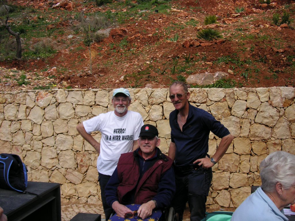
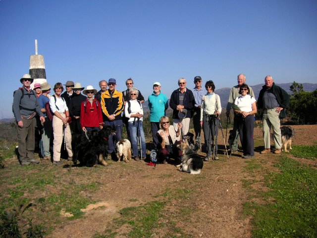
Jump to the present day. Despite fears that age and infirmity would deplete the group, there has been a steady influx of new blood, and a willingness to lead and discover new walks. The present standard is that winter, ie October to May, walks will be of around 4-6 hours and 12 to 24 km. Occasionally longer, but rarely shorter, except for special reasons. Occasionally there are special events;- an annual Round The Corner Walk, two days of 30 km per day from Carrapateira to Sagres and Sagres to Luz(photo is of the 2006 crew!); the Trans Algarve Via Algarviana, ca. 240 km and walked in sections; and random trips to Spain or other parts of Portugal as the whim takes us.
I have just realised how boring this is becoming, so I will cut to the chase: What is this blog for?
It has long been appreciated that owing to the lack of good accurate walking maps, our collection of walks has largely remained in the heads of those that lead them. Obviously there is a danger that should one of the key leaders become incapacitated, or leave the Algarve, or boycott the group in a huff because of a real or perceived disagreement, then his/her collection of walks will be lost to posterity. All of the three previous examples have happened.
We have been lucky that Maurice had recorded a collection of his favourite shorter walks for publishing, before his incapacity, but we sorely miss his knowledge of the Algarve, and enthusiasm for the Via Algarviana project, which was to create a route across the Algarve from Alcoutim on the Spanish border to Cape St Vincent, the most southwesterly point in Europe. The baton has been taken up most recently by David Littlewood and Terry Ames, who are recording and walking the route as I write. I will leave it to either of them to contribute on their project.
Last Wednesday, was the second walk of The Year of the Dog, and we are fortunate enough to count a number of dogs among our most enthusiastic members. It fell to my lot to lead the walk on February 8th 2006 and this was for me a new walk among untrodden ways. My MO for researching a walk has, hitherto been to think of an area, to take a drive around as much of the area as I could in the G- Wagen, and then to walk the walk leaving clues as to which path to take, or handwritten notes. This was not always satisfactory, and MISTAKES HAD BEEN MADE!! When helping Maurice with his notes for his published walks, it was easy to see the problems of a written description of a walk. Mike Pease compensates for his failing memory by producing 'Thumbnail notes' of his walks, which are typed in a minute font on a plasticised card hanging round his neck, and which work for him, but he has the eyes of an 18 year old!
One of my other hobbies is Classic car Rallying, and although we mostly keep to metalled roads, the accepted form of directing the participants is to use a 'Tulip' Road book, apparently so named because it was first used in The Tulip Rally in Holland many years ago. This, in its simplest form, gives the distance to a feature or turning, and combines with a pictogram of the said point, to enable the navigator to tell the driver where to go!! All you need is a reasonably accurate distance measurement in your car, and away you go.
I determined to trial this method for walking, although the distances I could measure with my pedometer were known to be at variance with official Euro km and metres. As this was open to argument, I decided also to add another indication - the TIME it took me to reach each of the features, and also an accurate pictogram of the feature and a short one or two word remark to aid in identification. I decided to call these "Bamboo Diagrams" with the fanciful notion that as the original diagrams looked nothing like Tulips, these could be imagined to look like a bamboo branch with various arrangements of leaves leading off!
Advantages proved obvious - the 20 km walk I planned was recorded on about 40 lines of instructions, in fairly large type on A6 size pages which could be handled as a booklet by the leader. Janet Somerfield undertook to 'lead' the walk using the Bamboo diagrams, and with due modesty, and a few gentle nudges from other walkers who had also been furnished with the booklets, we arrived back at our start point in fairly good order, and almost on time.
I intend to try and record most of our future walks using this method, and if practical publishing them on this blog. The blog will also serve as a short memorandum of each walk with regard to those attending, and any items of interest that occur or are raised during the walk. The list of those present will put paid to any contentious issues on who qualifies for the end of season blow out, as a subsidised contributor! Worth it for that alone!
Now all I have to do, having opened this work without knowing how to present or lay it out, is to familiarise myself with the proceedings and make it happen!!!
Been thinking about something like this for some time, so decided to get in before someone else rouses from their winter torpor and beats me to it!
The Algarve Wednesday Walkers were founded back in the mists of time, by a loose collection of friends who had among others, two things in common. They liked walking and they lived in or spent a significant amount of time each year in the Algarve. By the time I came on the scene, there were two distinct sets of Algarve walkers, the Saturday Strollers and the Wednesday Striders, and to be fair there was an overlap between the members of each. Things evolved, and by 1998, there was a hardy and elite group of ramblers, who became known as the Algarve Wednesday Walkers, principals being Maurice Clyde, Rod Frew and a core of 6 or 7 leaders, (and Myriam who seemed to be in charge!), who were prepared to research and lead walks, on a rotational basis. Numbers fluctuated, but usually a dozen or so would turn out, and occasionally many more, when the "Winter Birds" arrived, or there was a meal or a celebration planned for after the walk.
Jump to the present day. Despite fears that age and infirmity would deplete the group, there has been a steady influx of new blood, and a willingness to lead and discover new walks. The present standard is that winter, ie October to May, walks will be of around 4-6 hours and 12 to 24 km. Occasionally longer, but rarely shorter, except for special reasons. Occasionally there are special events;- an annual Round The Corner Walk, two days of 30 km per day from Carrapateira to Sagres and Sagres to Luz(photo is of the 2006 crew!); the Trans Algarve Via Algarviana, ca. 240 km and walked in sections; and random trips to Spain or other parts of Portugal as the whim takes us.
I have just realised how boring this is becoming, so I will cut to the chase: What is this blog for?
It has long been appreciated that owing to the lack of good accurate walking maps, our collection of walks has largely remained in the heads of those that lead them. Obviously there is a danger that should one of the key leaders become incapacitated, or leave the Algarve, or boycott the group in a huff because of a real or perceived disagreement, then his/her collection of walks will be lost to posterity. All of the three previous examples have happened.
We have been lucky that Maurice had recorded a collection of his favourite shorter walks for publishing, before his incapacity, but we sorely miss his knowledge of the Algarve, and enthusiasm for the Via Algarviana project, which was to create a route across the Algarve from Alcoutim on the Spanish border to Cape St Vincent, the most southwesterly point in Europe. The baton has been taken up most recently by David Littlewood and Terry Ames, who are recording and walking the route as I write. I will leave it to either of them to contribute on their project.
Last Wednesday, was the second walk of The Year of the Dog, and we are fortunate enough to count a number of dogs among our most enthusiastic members. It fell to my lot to lead the walk on February 8th 2006 and this was for me a new walk among untrodden ways. My MO for researching a walk has, hitherto been to think of an area, to take a drive around as much of the area as I could in the G- Wagen, and then to walk the walk leaving clues as to which path to take, or handwritten notes. This was not always satisfactory, and MISTAKES HAD BEEN MADE!! When helping Maurice with his notes for his published walks, it was easy to see the problems of a written description of a walk. Mike Pease compensates for his failing memory by producing 'Thumbnail notes' of his walks, which are typed in a minute font on a plasticised card hanging round his neck, and which work for him, but he has the eyes of an 18 year old!
One of my other hobbies is Classic car Rallying, and although we mostly keep to metalled roads, the accepted form of directing the participants is to use a 'Tulip' Road book, apparently so named because it was first used in The Tulip Rally in Holland many years ago. This, in its simplest form, gives the distance to a feature or turning, and combines with a pictogram of the said point, to enable the navigator to tell the driver where to go!! All you need is a reasonably accurate distance measurement in your car, and away you go.
I determined to trial this method for walking, although the distances I could measure with my pedometer were known to be at variance with official Euro km and metres. As this was open to argument, I decided also to add another indication - the TIME it took me to reach each of the features, and also an accurate pictogram of the feature and a short one or two word remark to aid in identification. I decided to call these "Bamboo Diagrams" with the fanciful notion that as the original diagrams looked nothing like Tulips, these could be imagined to look like a bamboo branch with various arrangements of leaves leading off!
Advantages proved obvious - the 20 km walk I planned was recorded on about 40 lines of instructions, in fairly large type on A6 size pages which could be handled as a booklet by the leader. Janet Somerfield undertook to 'lead' the walk using the Bamboo diagrams, and with due modesty, and a few gentle nudges from other walkers who had also been furnished with the booklets, we arrived back at our start point in fairly good order, and almost on time.
I intend to try and record most of our future walks using this method, and if practical publishing them on this blog. The blog will also serve as a short memorandum of each walk with regard to those attending, and any items of interest that occur or are raised during the walk. The list of those present will put paid to any contentious issues on who qualifies for the end of season blow out, as a subsidised contributor! Worth it for that alone!
Now all I have to do, having opened this work without knowing how to present or lay it out, is to familiarise myself with the proceedings and make it happen!!!
posted by Paulo a Pe | Monday, February 13, 2006
|
0 comments
![]()
![]()